Darby DeBruhl
GIS Analyst
About
Darby DeBruhl — GIS Analyst, Database Manager, and Cartographer
- Age: 26
- Education: B.A. in Geography and History
- Email: debruhld@gmail.com
- Website: https://debruhld.com
Hi! I'm Darby. I'm a GIS Analyst from the humid southeast. Currently, I work for the South Carolina Geological Survey, where I manage geodatabases, create geologic maps, and handle all things GIS. I am currently in the process of relocating to Southern California to be closer to family.
My professional experience has allowed me to dip my toes into a wide range of GIS technologies. On a daily basis, I employ some combination of ArcGIS Pro, ArcGIS Online, Python, R, Javascript, and dozens of other tools to support non-GIS staff and further the goals of the agency in addressing environmental problems. As SCGS's primary representative for the U.S. Geological Survey's Geologic Map Schema program, of which SCGS is a renowned contributor, I also have extensive experience in collaborating across agencies.
More than anything, I love to learn — teaching myself something new and putting together a creative solution is the best feeling in the world! I also have a strong sense of visual design, often finding myself particularly drawn to the artistic elements of cartography that commonly go overlooked.
This is my personal portfolio website, which offers a copy of my resume and a brief sampler of my work. If you're interested in having a deeper conversation about anything presented here, don't hesitate to reach out!
Resume
A one-page PDF version of my resume is available here! Feel free to download a copy for your records.
Summary
Darby DeBruhl
Creative and detail-oriented GIS Analyst with 5 years of experience working with geospatial data. Extensive experience with:
- Esri’s ArcGIS software ecosystem, including ArcGIS Pro, ArcMap, ArcGIS Online, Field Maps, Instant Apps, ArcGIS Hub, StoryMaps, etc.
- QGIS
- Python
- Javascript
- HTML & CSS
- Adobe Illustrator and Photoshop
Education
Bachelor of Arts in Geography and History
2017 - 2021
University of South Carolina, Columbia, SC
Dual major with a concentration in GIS. Relevant coursework:
- Advanced GIS
- WebGIS
- GIS-Based Modeling
- Spatial Programming
- Interpretation of Aerial Photographs
- Principles of Remote Sensing
Professional Experience
GIS Analyst, Database Manager, and Cartographer
2021 - Present
South Carolina Geological Survey — Columbia, SC
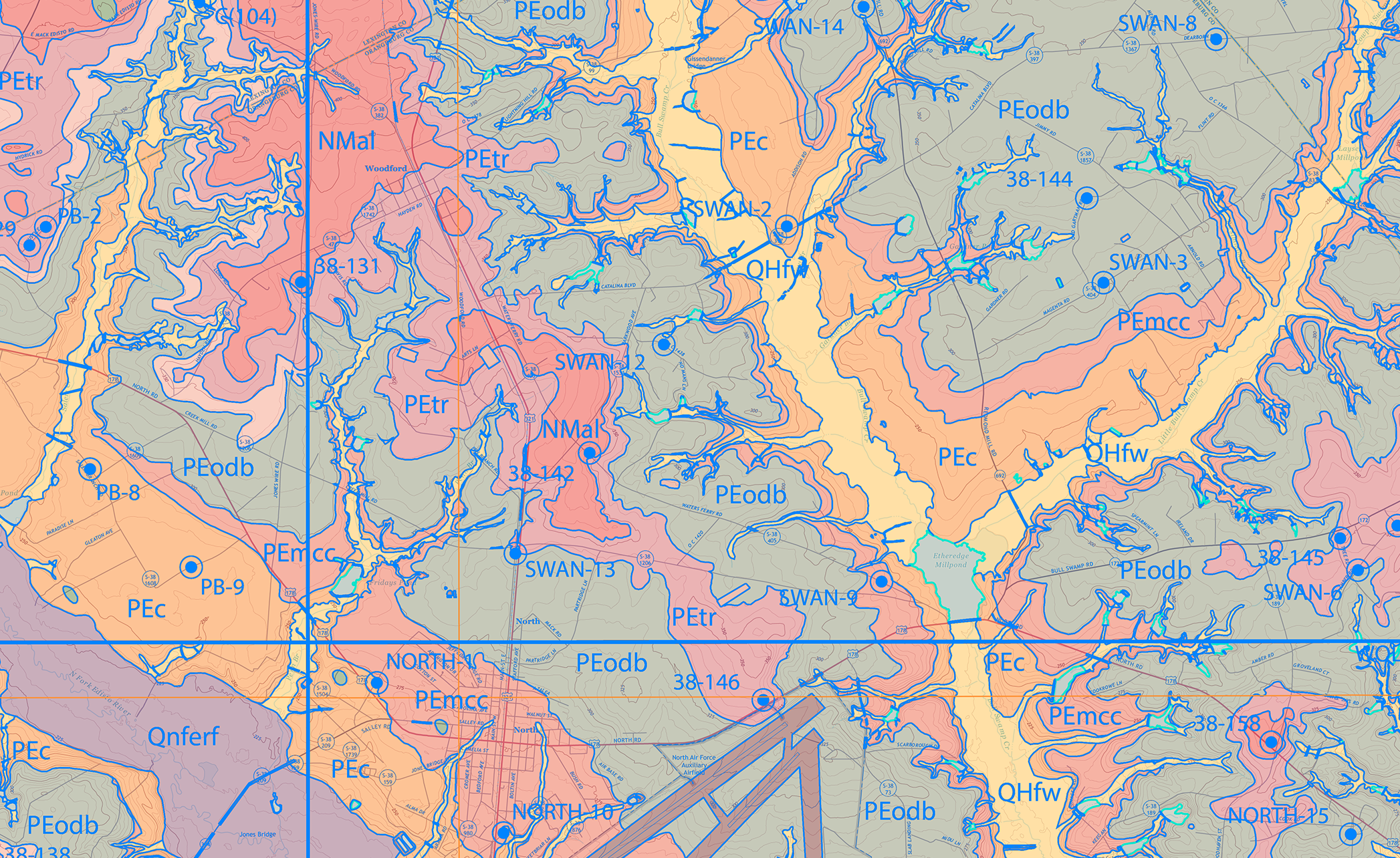
- Produces and manages spatial databases, metadata, and other ancillary documentation for geologic maps of South Carolina.
- Uses cartographic principles and GIS techniques to prepare geologic maps and data for publication alongside cartographer.
- Sets up GIS projects for and provides technical assistance to geologists and other non-GIS staff.
- Evaluates maps and data produced by others for cartographic quality and technical accuracy per SCGS Mapping standards.
- Primary representative for SCGS in the USGS’s Geologic Map Schema (GeMS) program; responsible for:
- Creating and maintaining the ArcGIS Pro style implementation of the FGDC Digital Cartographic Standard for Geologic Map Symbolization (5,000+ individual symbols).
- Representing SCGS in GeMS-related decision making and schema design alongside USGS and other state surveys.
- Ensuring GeMS-compliancy for all SCGS’s federally funded mapping.
- Writing concise workflows and tutorials for newcomers to the GeMS schema, both within SCGS and nationwide.
- Devises enhancements for field workflows involving ArcGIS Survey123 and ArcGIS Field Maps in both Piedmont and Coastal Plain mapping environments.
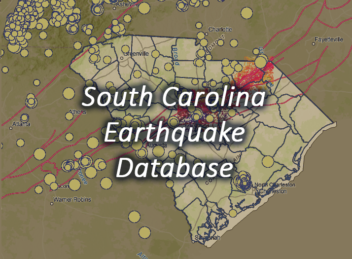
- Employs Python in miscellaneous geological applications; examples include the development and maintenance of SCGS’s Earthquake Database, custom geoprocessing tools, automation of GIS-related tasks, etc.
- Responsible for distribution of GIS data to the public.
- Responsible for managing and assigning tasks to rotating teams of GIS student interns.
North Inlet-Winyah Bay National Estuarine Research Reserve
January - April 2021
Baruch Institute for Marine & Coastal Sciences | 2306 Crab Hall Rd, Georgetown, SC 29440
- Served as an intern in the only designated GIS position at the Reserve.
- Responsible for gathering, managing, processing, and vectorizing historic aerial photos and T-sheets of the Winyah Bay area to map shoreline change for conservation purposes.
- Independently developed a small tool using arcpy to make the process of vectorizing large raster datasets faster and more efficient. Further details are available upon request.
- Used USGS’s Digital Shoreline Analysis System (DSAS) to perform basic shoreline change analysis.
Gills Creek Watershed Association
August - December 2020
712 Main St EWS 603, Columbia, SC 29208
- Served as a GIS student intern in a collaborative team with four other students.
- Responsible for gathering and mapping demographic data in ArcMap. Using this data, basic statistics were computed to answer questions pertaining to environmental justice within the Gills Creek watershed.
- Final deliverables available for review upon request.
Portfolio
Some samples of my work can be found below. This includes cartography, public-facing apps, tool development, and more -- but I'm always open to trying new things!
- All
- Maps
- Apps & Programming