Portfolio Details
Project information
- Category: Apps and Programming
- Project date: June 2021
- Code available upon request.
South Carolina Earthquake Database
The goal of this project was to design a self-updating database of earthquakes that occur in and around South Carolina. I achieved this with a script written in Python, which runs as both a custom geoprocessing tool in ArcGIS Pro and as a standalone application. The data collected by the script is automatically added to an ArcGIS Pro project alongside other relevant geological data (Slide 1), where it is used to study seismic phenomena in SC and inform real-world decision making. Before the development of this tool, all records were entered into the database manually, naturally leading to errors and delays.
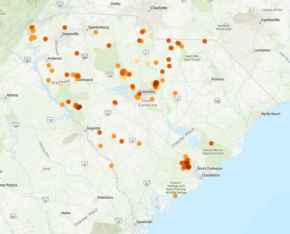
The script updates a geodatabase by fetching data from the USGS's earthquake API. Data posted by the USGS after the date of last runtime is downloaded to a scratch CSV, plotted using lat/long coordinates, appended to the main feature class, and filtered for duplicates. The script also detects and overwrites any previously-downloaded records that have been updated by the USGS, which is not unusual a few days or weeks after a quake. Feature classes are linked to automatically-updated ArcGIS Online layers, through which the data is viewable online in StoryMaps and other SCGS applications (Slide 2). The script can be run by a user, but it also runs autonomously at 12pm EST every day.
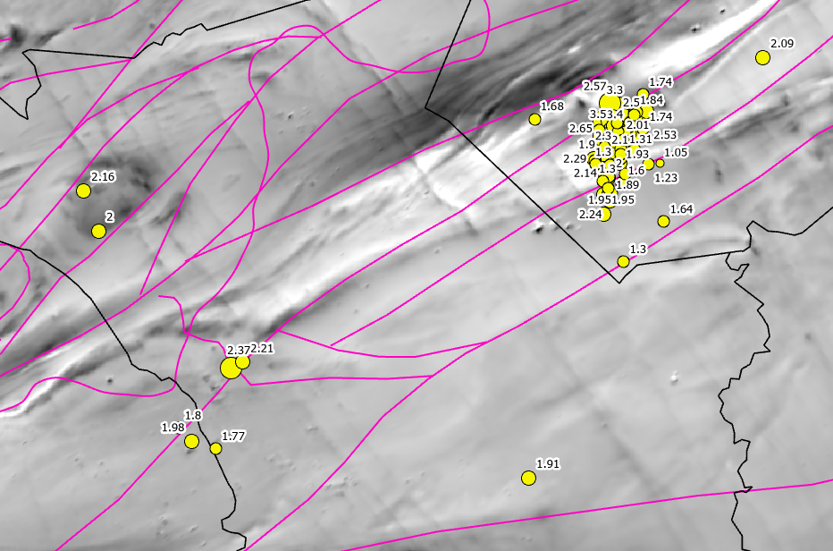
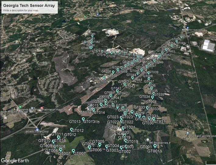
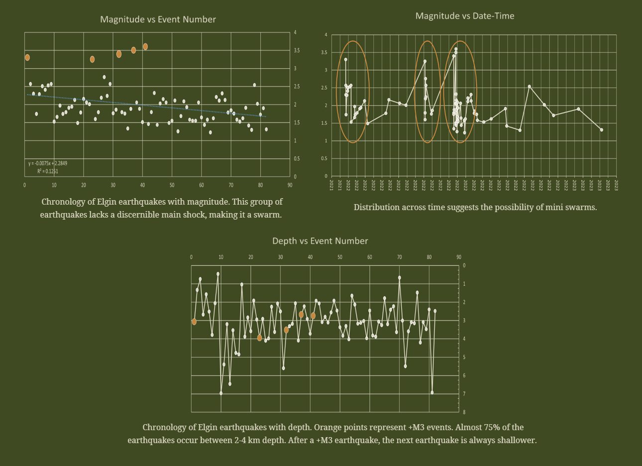
The data collected by this tool has allowed the State Geologist to easily observe spatial trends; for example, SCGS has recently been able to identify the Eastern Piedmont Fault System as the likely source of a significant earthquake swarm around Elgin, SC (Slide 1). It has also allowed us to identify ideal locations for the placement of seismic sensors (Slide 3), which have greatly contributed to our knowledge of the swarm. For the geologists who have written reports or given presentations on the swarm, keeping the data automatically stored and updated in a clean tabular format has made the visualization of statistics considerably simpler (Slide 4). Given SC’s history of earthquake hazards, keeping SCGS on the pulse of seismic activity in the state is incredibly important to public service.