Portfolio Details
Project information
- Category: Map
- Project date: January 2025
- Hi-res PDF available for view here.
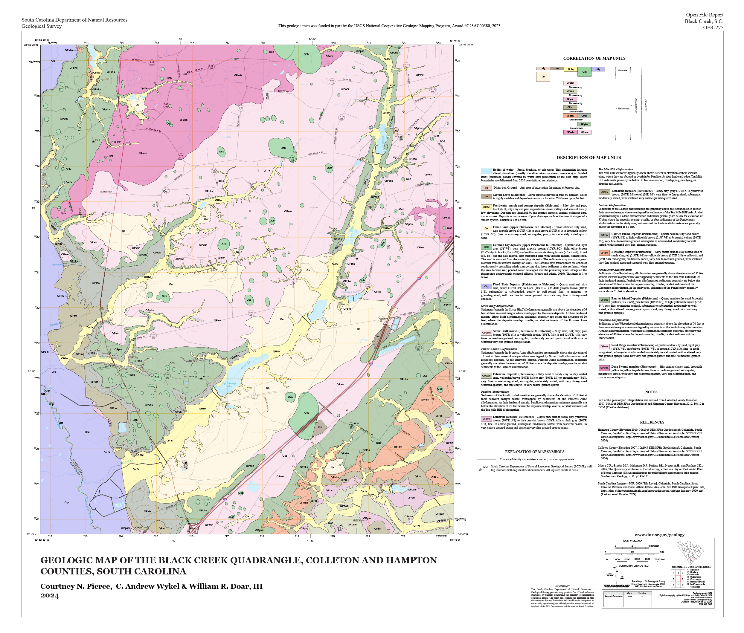
Geologic Map of the Black Creek Quadrangle
Black Creek is just one of the many 7.5-minute (1:24,000 scale) geologic quadrangle maps that I produce on a regular basis. I create and manage the geodatabases and metadata for these products in ArcGIS Pro using data collected by field geologists in ArcGIS Online. Black Creek is located in the Coastal Plain region, meaning this quadrangle was mapped primarily through drill holes that were logged in Survey123.
In the field, geologists use Survey123 to record the locations of drill holes, which they interpolate to map the surficial geology of an area. Using a few Python scripts written by myself and an intern, the Survey123 form is converted to a spreadsheet and reformatted for use with Strater, which is used to create geologic cross sections.
After the contents of the map are complete on a scientific level, I then use the ArcGIS Maps for Adobe Creative Cloud extension to export the data and design the PDF version of the map in Adobe Illustrator. This process is more technical than it is artistic; all map products must be in accordance with the FGDC Digital Cartographic Standard for Geologic Map Symbolization, the ArcGIS implementation of which I designed with a colleague.