Portfolio Details

Geology of the Orangeburg Area — 1:100,000 Compilation
Project information
- Category: Map
- Project date: September 2024
- Hi-res PDF available here.
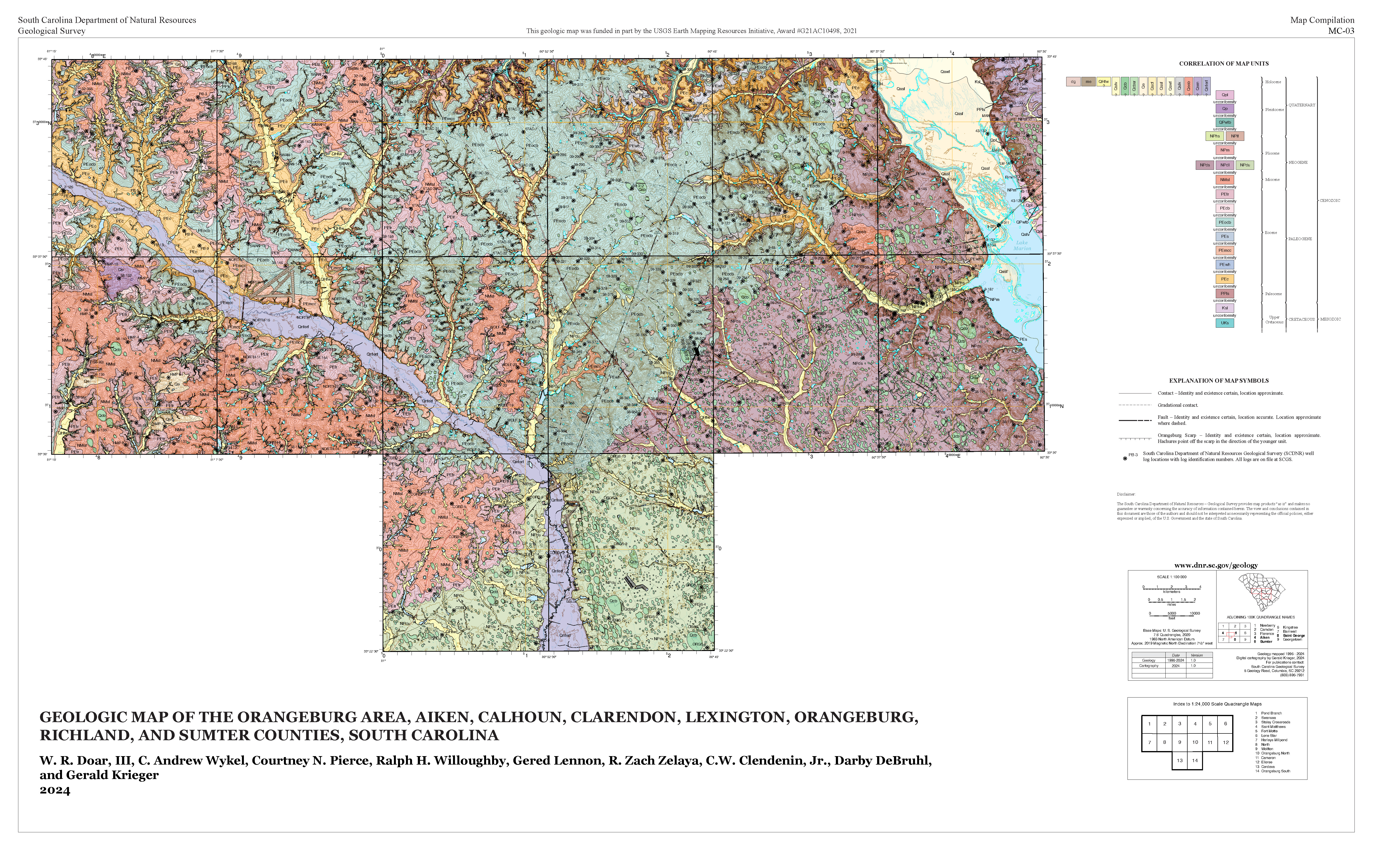
This is a compilation of 14 separate 7.5-minute quadrangles in the Orangeburg, SC area, funded by the USGS’s Earth Mapping Resources Initiative. The overarching goal of this project is to identify sources of rare earth elements within the US, decreasing our reliance on foreign suppliers.
Because this map’s constituent quadrangles were mapped over a 25-year-period by several different teams of geologists, I had to reinterpret the original geology extensively to edgematch and compile them. I did this by studying DEMs and historical aerial imagery, organizing meetings with and between SCGS's Coastal Plain geologists along the way.
I also wrote the drafts of all of the map unit descriptions on Sheet 2, created, managed, and submitted the final geodatabase and its metadata, and provided input on cartographic choices.